
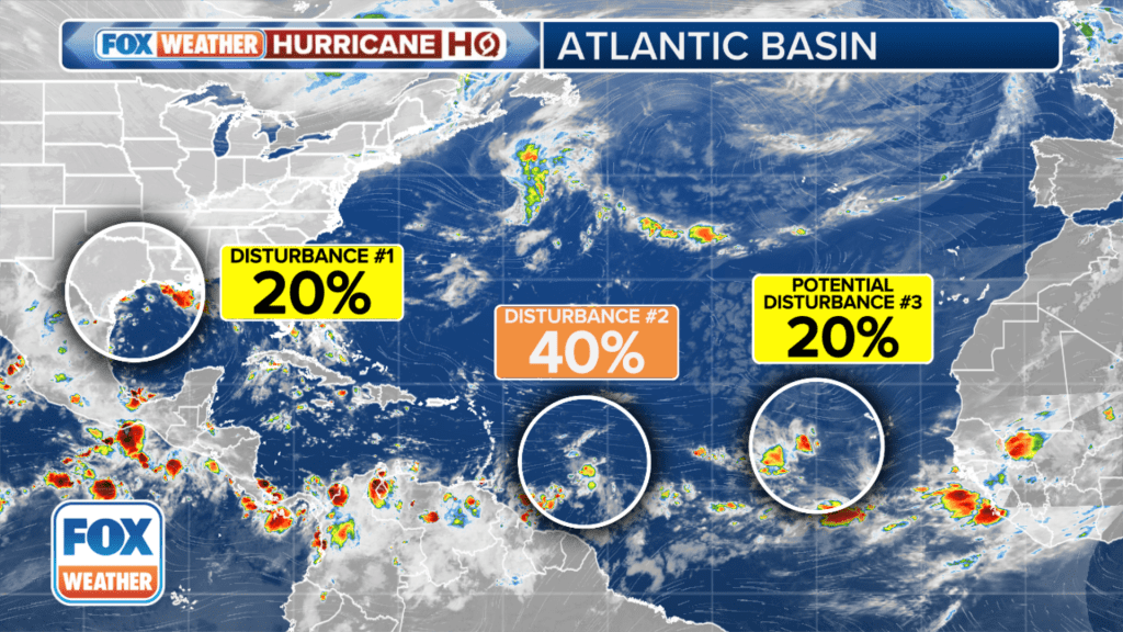
MIAMI – The National Hurricane Center (NHC) is keeping its eyes on a few disturbances for potential tropical development, but it’s the one swirling a few hundred miles east of the Lesser Antilles in the Atlantic that is the primary focus for forecasters.
The NHC says that disturbance is east of the Caribbean and the shower and thunderstorm activity associated with it continues to show signs of organization.
“Late next week, this system could be over extremely warm water and under conducive atmospheric conditions for strengthening in the western Caribbean Sea,” said FOX Weather Hurricane Specialist Bryan Norcross. “But it has to get organized first, so no confident forecasts are possible.”
The NHC has been bouncing the odds of the storm’s tropical development between 40-50% over the next week, a level which Norcross thinks it’ll remain until the system shows better signs of organization.
“Many long-range forecasts show the system bending to the north into the Gulf (of Mexico) around next weekend, but that’s so far out that we can’t pay attention to any specific forecasts,” Norcross said. “At this point, just be aware of a potential storm threat near Mexico’s Yucatán Peninsula about next weekend, and in the Southeast the following week.”
The NHC said a disturbance off the coast of Africa has fizzled and is no longer being monitored, however a new threat could emerge in the area soon.

The NHC said a tropical eave moving over western Africa is forecast to move offshore on Monday, and environmental conditions could support some slow development through the upcoming week while it moves slowly to the west or west-northwest over the eastern tropical Atlantic Ocean.
Disturbance in Gulf Coast maintains low odds of development but flooding threat persists
A trough of low pressure currently producing a large but disorganized area of thunderstorms along and just offshore the Texas and Louisiana coasts is still clinging to a low chance of tropical development, the NHC says.

With little in the way of winds to steer the system, storms are expected to meander near the coast through much of next week. But some slow tropical development is possible if the system remains offshore over the warm Gulf of Mexico waters, according to the NHC.
Right now, the NHC is only giving low odds of development into at least a tropical depression within the next week. The agency warned that regardless of tropical development, heavy rains could cause flash flooding along portions of the Louisiana and upper Texas coasts over the next few days.
Recent Comments