
 Jauncey Lane, once an old country road known as Apthorp Lane, dates from Manhattan’s colonial days. It was one of the many paths lined with farms and country houses that once crisscrossed Manhattan Island.
Jauncey’s Lane got its name from wealthy Englishman William Jauncey, who purchased Charles Ward Apthorp Jr.’s Elmwood. Also called “Apthorp’s Lane” or simply the “Crossroad to Harlem,” it extended eastwards to Harlem Commons later taken into Central Park.
The Lane played a part in the Battle of Harlem Heights on September 16, 1776. It was the route the British General Henry Clinton took to cut across the island after marching up from the city along the Boston Post Road.
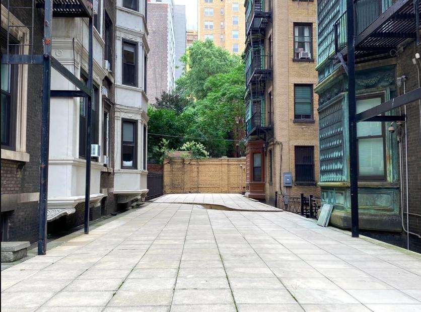
Vestiges of this lane can still be seen today in the mid-block break between apartment buildings fronting Broadway just north of the northwest corner of 91st Street and running diagonally west to West End Avenue, and formerly all the way to Riverside Drive.
Suzanne Wray and Jim Mackin, members of the Bloomingdale Neighborhood History Group, have researched the lane’s history and assembled an illustrated presentation tracing its beginnings up to the 19th century.
They will present their research in a free online presentation on Thursday, February 20th at 6:30 pm, ET. A link to the event can be found here.
This event is cosponsored by the Bloomingdale Neighborhood History Group and the Columbus Amsterdam BID.
Photo: Recent photo of a piece of the former Jauncey Lane, looking east from Riverside Drive, between West 91st and 92nd Streets (photo by Jim Mackin).

Recent Comments